& Construction

Integrated BIM tools, including Revit, AutoCAD, and Civil 3D
& Manufacturing

Professional CAD/CAM tools built on Inventor and AutoCAD
Autodesk InfraWorks® conceptual design software helps you model and understand design projects, in context. Use it to:
Aggregate large amounts of data to generate information-rich context models
Visualize conceptual design options for roadway, rail and transit, bridge, and water infrastructure projects
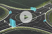
Analyze traffic flow through intersections and conduct line-of-sight studies to visualize impacts
InfraWorks overview (video 1:29 min.)
Analyze impacts with traffic simulation (video: 56 sec.)
Creating custom bridge components using Revit families (video: 1:07 min.)
Bring together extensive data from different sources to ground your designs in reality.
Rapidly conceptualize, evaluate, and iterate on roadway, site, rail, water, and other infrastructure projects.
Produce photorealistic visualizations to improve understanding and communicate your designs.
Context modeling for site design (2:25 min.)
Aggregate large volumes of data to generate contextual models, seamlessly integrate geospatial data into designs, and model existing conditions that represent built and natural environments.
Visualization scenarios of different infrastructure (2:52 min).
Explore conceptual designs in context that allow you to visualize your project under different weather conditions or integrate your GIS data to explore existing conditions to understand design impacts.
Simulation examples of different civil infrastructure projects (1:17 min).
Reduce overall design time with automated analysis and design tools. Analyze the impact of the surrounding natural and built environment within your project scope with different simulation tools.
WEBINAR
Manage project complexity and reduce design time with conceptual design.
BLOG
See the latest updates on creating information-rich context models.
ROADMAP
See what’s new in the product development pipeline with a live look at the Civil Infrastructure public roadmap.
InfraWorks lets architecture, engineering, and construction professionals model, analyze, and visualize infrastructure design concepts within the context of the built and natural environment.
Civil engineers, civil designers, and other civil infrastructure professionals, including urban planners and surveyors, use InfraWorks during the planning and design phase of infrastructure projects.
Your InfraWorks subscription gives you access to install and use the 3 previous versions. Available downloads are listed in your Autodesk Account after subscribing. See also previous releases available for subscribers.
Connect InfraWorks with tools for reality capture, detailed design, analysis, and construction documentation. Improve coordination on horizontal and vertical design projects and support multi-discipline processes with a cloud-based common data environment.
InfraWorks
Civil 3D
Context modeling
Conceptual design
Analysis and simulation
Visualization


